
Long Trail: A New Approach - Day 5

Day 5 - Friday 7/15/2022
Emily Proctor Shelter (141.2) to Duxbury Road Trailhead (181.9)
40.7 miles / 11,276 ft gain / 12,869 ft loss
2.3 mph
Start: 2:50am
Finish: 8:29pm
Elapsed: 17h 39m
Since I had stopped so early yesterday evening, I got an extra early start today to allow enough time to get to my next destination, the Duxbury Road Trailhead past Camel's Hump. Prior to starting the trail, I'd parked my car there with my next resupply box inside, plus I threw in an extra sleeping pad, fuzzy blanket, and soft pillow so I could sleep in my car and not have to make camp! I reached out to Fastest Known Time ahead of time to make sure "caching" my car at the trailhead fell within the self-supported guidelines, and they said yes. So, similarly to how I wanted to reach the Long Trail Inn where my resupply box was waiting (plus a hot meal) on day three, I was very motivated to reach the Duxbury trailhead by the end of day five.
Getting ready in the morning was extremely frustrating and slow going, by my own fault. Conscious of the two other hikers sleeping in the shelter and not wanting to wake them up, I got ready as quietly as I could (which probably still wasn't very quiet), and changed and packed up my stuff in all the wrong order and just stuffed things wherever they'd fit using my headlamp as little as possible. The moon was shining brightly, so I could actually see okay without it, though I fumbled around a lot and everything just took longer than usual. Honestly if I had just not worried about making noise and used my headlamp, I would have gotten out of there way sooner even if it meant being annoying to the boys for 20-30 minutes in the middle of the night. Ugh, oh well!
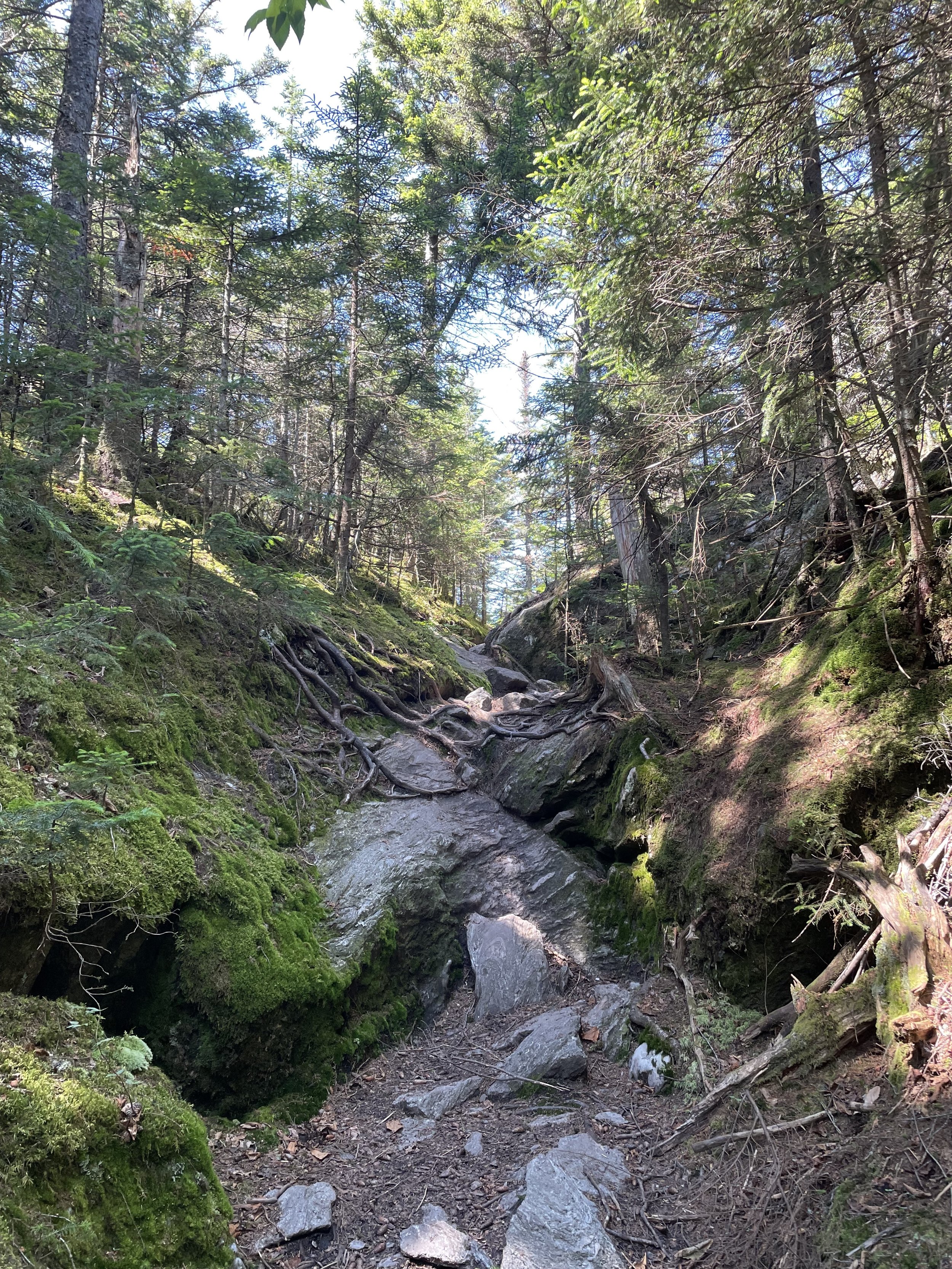
As I made my way down the trail toward the next shelter, I no longer regretted stopping early the night before, as the miles continued to be difficult and slow going. It was better to do it on rested legs at the beginning of the day, rather than tired legs at the end of the day. I paused to click off my headlamp and admire the view from a clearing, the silhouettes of mountains illuminated all around me by the moonlight.
I found myself feeling very grumpy and annoyed knowing that all the stuff in my pack was disorganized, to a point I couldn't focus on hiking. I also hadn't done much to "get ready" in the morning like brush my teeth and put sunscreen on my face and neck like I usually do, which felt bothersome. Going through the very brushy wilderness I also just felt like I had bugs and cobwebs and dirt all over me and I just felt gross. As soon as it got light out, I threw down my pack and took maybe 10-15 minutes to completely reorganize everything and put all the food I needed in the front pouches of my pack for easy access throughout the day (I knew the sound of crinkling wrappers would be loud, so I hadn't done it earlier). Then I wiped down my face and neck and put on sunscreen, ate breakfast (a boring energy bar, probably), brushed my teeth, and clapped the dirt out of my shoes. Ahhhh. Way way better. Feeling "put together"–clean-ish, organized, and ready for the day–did wonders psychologically.

The trail started to descend to Lincoln Gap, and I could hear voices echoing down below. Civilization! Kind of. I mean, it was just a road with a parking lot but it was very exciting all the same. It was fully light out at this point and I felt bouncy and energetic. I bounded up the trail from Lincoln Gap, feeling a little boost as I remembered really liking this section when I hiked it southbound the year before. I climbed to the top of Mt. Abraham, and turned around and gasped at the view behind me to the south. Look at all those mountains behind me! I climbed up and down all of those and now I'm here! From there, the trail crossed and occasionally followed some ski slopes and meadows and I paused every so often to admire the wildflowers and butterflies.

The only downside was that water was very hard to come by. It hadn't rained since the storm on Tuesday and the mountains were very very dried up. This was awesome in terms of the trails being dry and not muddy! Some of the ski lodges (basic cabins open to hikers) had some rainwater caches outside but I felt nervous about drinking from them. Anyone could dump anything in those caches (I was imagining dirty dish water or someone brushing their teeth and spitting out their backwash.. I don't know!). Who knew what was in there? So I just conserved the water I had and prayed the streams past Appalachian Gap would still be flowing.
Crossing Vermont Route 17 at Appalachian Gap was very exciting. It's where I'd given up on my supported attempt the year prior, now here I was five days into my northbound hike and entering familiar territory, as I'd done this next section plenty of times now. I was nearly out of water, so it made me a little nervous to leave the last road I'd see for eighteen miles, and eighteen tough miles at that. I asked a couple hikers going the opposite direction if they'd seen any flowing water up ahead. The first hiker said "no" (great) but the second hiker said, "Oh yeah, there are a few with at least a trickle coming right up in the next mile!" Thankfully I came across a flowing stream not long after. I sat down for several minutes, drank my fill, ("cameling up" before Camel's Hump, if you will), and filled up my bottle to the brim. Ahh!
Up, up, and up to Burnt Rock
I caught a nice view of Camel's Hump at Molly Stark's Balcony then descended down to Birch Glen Lodge. A "lodge" in this case usually means a shelter that's fully enclosed with a door, opposed to the typical three-walled lean-to. I remembered from my practice hikes that the trail was pretty easy going from there to Cowle's Cove Shelter, but then after that was tough, tough, tough.

The thing is, you get rewarded greatly for all the tough climbs in this section with just beautiful views and open ledges. Burnt Rock was a delight to climb up and over, with plenty of big slab rocks that I could walk over like a sidewalk. Next was Mount Ethan Allen with a fantastic overlook to the east. Then came the mother of them all: Camel's Hump, an open and exposed rocky, climb-y 4,000 footer. I was already something like thirty miles into the day, and this was a serious climb. A fair amount of day hikers were out and I got lots of compliments for doing a climb like that with my big pack, which made me feel good.

Mercy!

Approaching the last bit of climbing to the summit of Camel's Hump
On the way up I heard my phone ding, so I paused and saw that I received a text message with some very good news, something that's been hanging over my head for a while. I let out a celebratory whoop and felt a weight being lifted off my shoulders. What amazing timing, having something in my "real life" working out as I'd hoped as I'm climbing up and over one of the most magnificent mountains on the Long Trail!

The summit of Camel's Hump with Bolton and Mansfield looming in the distance
I paused at the summit to take a few photos then started the long, long, long descent down to the trailhead where my car was waiting. Similarly to how I felt descending Killington on day three, I felt ragged and exhausted and ready to be done. If it weren't for my resupply box, a "real" meal of packaged and ready-to-eat rice and beans, and a fuzzy blanket and pillow waiting for me at the Duxbury Trailhead, I surely would have called it a day at Bamforth Ridge Shelter on the way down.
But, I was motivated, so I just continued to chug water, take my electrolyte salt tabs, and eat (I was so sick of eating, it felt like a chore). It had been a long day and I felt proud of myself for how far I'd come. I'd continued my streak of not needing to click on my headlamp at night, which felt pretty neat. The last few miles of trail were not difficult, and the forest was pretty and orangey as the sun went down. I sighed happily as I reached the trailhead just before 8:30pm, and let out an extra sigh of relief seeing that my car had not been broken into or vandalized, considering it had been sitting there since Sunday, the day before I started. I dove in, blasted the AC, cleaned myself up, charged up my electronics, emptied my pre-packaged rice and beans into a big mixing bowl and chowed down, and felt happy as a clam.
I had just 88 miles to go from there to Canada, and I'd planned to cover 36.4 miles the next day to Bear Hollow Shelter. It would be a tough day, starting at the lowest point of the trail, the Winooski River Valley at 330', to the highest point of the trail and Vermont itself, Mt. Mansfield at 4,395'. Then beyond that, a big descent from Mansfield followed by a long climb up Madonna Peak and Sterling (Whiteface) Mountain, the mountain that had broken me just two weeks prior in my second record attempt. Then down the other side to my destination, Bear Hollow Shelter. To achieve a record, I'd have to finish by 11:33pm two nights from now, Sunday night. I was under no illusion about how hard the remaining miles would be. In fact, I already felt content figuring I'd finish sometime on Monday or Tuesday, and that was okay. I was out here for fun.
I started thinking about how I'd better keep in touch with my friend Ted, who had agreed to pick me up at the end and let him know a Sunday night finish probably wasn't in the cards. My friend Allison texted me just before I drifted off to sleep, asking if I felt good and ready to close it out. I felt like laughing as I didn't feel close to the end at all. I didn't feel upset or sad about it, just realistic, and content to continue the journey at my own pace. The end would have to wait.
💫
Thanks for reading. Stay tuned for more daily recaps of the rest of my Long Trail journey right here on Mercury on the Run.
To celebrate completing my thru-hike and Long Trail Day coming up on September 10th, I'd like to give back to this trail I love so much by fundraising $2,720 for Green Mountain Club, the maintainers of the Long Trail – that's $10 for every mile of the trail! With your support I have so far fundraised $878- that's like starting from the southern terminus (mile 0) and getting all the way to Clarendon Shelter (mile 87.8), just before the big climb up Killington! Can you donate to support me in my goal?

I'm also working on a special Long Trail-themed project for new and continuing Buy Me a Coffee monthly members. I'm so thankful for your support and love getting to share my journey with this little community. Support me as a monthly member and not only will you get two beautiful Mercury on the Run stickers and a handwritten thanks from me, you'll receive a one-of-a-kind memento from my time here in VT.

Another great way to support is by sharing this with someone that might enjoy it too, and if you haven't already, subscribe to my weekly newsletter. 'Til next time! ~Mercury